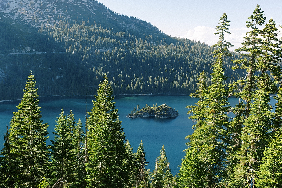
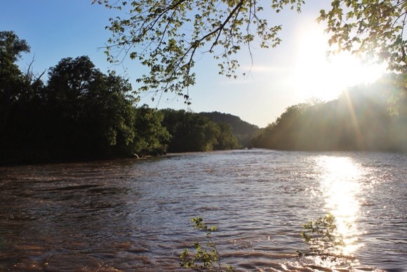
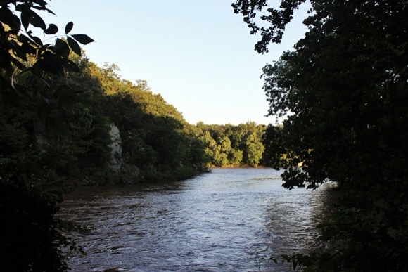
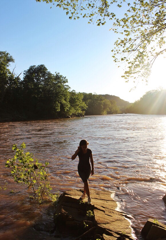
Fazia tempo que não ia em uma trilha e estava querendo muito. Convidei alguns amigos e então fomos para a trilha Billy Goat em Maryland nesse fim de semana. Estava procurando por uma trilha fácil e essa foi perfeita, do jeito que queria. A vista ao longo do Rio Potomac é linda. Foi bem relaxante e me fez esquecer de tudo por um tempo e só viver o momento.
It’s been a long time since I’ve gone hiking and I was wanting to so badly. I invited some friends and then we went to the Billy Goat trail in Maryland this weekend. I was looking for an easy trail and it was perfect for what I wanted. The view along the Potomac River was beautiful. It was so relaxing that it made me forget about everything for a while and just live in the moment.
ESTACIONAMENTO
Coloquei o nome da trilha no Google Mapas e me levou para uma rua residencial. Então dirigi um pouco mais e encontrei um estacionamento grátis de frente para o Old Angler’s Inn.
PARKING
I put the trail’s name in Google Maps and it took me to a residential lane. So I drove a little bit more and found free parking right at the front of the Old Angler’s Inn.
TRILHA
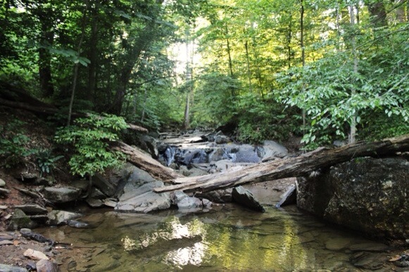
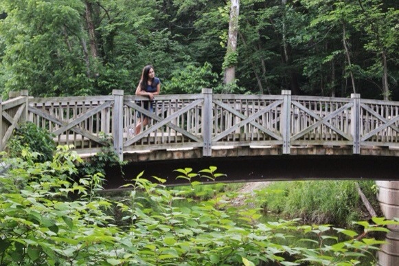
A trilha é dividida em três seções, A, B e C, que começam e terminam no Canal Chesapeake e Ohio. Escolhemos a seção B, e pra chegar lá descemos saindo do estacionamento até cruzar uma ponte, viramos pra direita até a placa de entrada para a seção B.
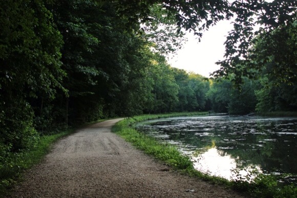
Levamos cerca de duas horas e meia para terminar a trilha com algumas paradas para comer, descansar e tirar fotos. No final da seção B pegamos esquerda e continuamos pelo Canal C&O para voltar para onde começamos. Tem alguns peixes bem grandes no canal, se você chegar perto consegue ver.
TRAIL
The trail is divided into three sections, A, B, and C that start and finish on the Chesapeake and Ohio Canal. We chose section B, and got there by going down from the parking lot, crossing the bridge and then turning left until we reached the sign to enter section B.
It took us about two and a half hours to finish the trail; with some stops to eat, rest and take pictures. At the end of Section B we took a left and kept walking along the C&O Canal to go back to where we started. There are some big fish in the canal, and if you get closer to the water you can see them.
DADOS
Não tem sinal de telefone em alguns lugares, e onde tem o sinal é bem pouco. Conseguiu usar o Google Mapas, que me deixou mais segura de saber onde estava. É uma boa ideia trazer um mapa impresso em caso que precise usar.
Gostei em parte de não ter sinal no telefone, assim consegui desligar completamente. Sem mensagens de texto, Facebook e Instagram. Eu sobrevivi!!
DATA
There is no cell phone network in some spots and the places with service have a very low signal. I could use Google Maps, and it made me feel safe to know where I was, but it’s a good idea to bring a printed map just in case.
To some extent I liked being with no cell phone network; it helped me to be offline for a while. No texts messages, Facebook or Instagram updates. I survived!!

Você gosta de trilhas? Quais lugares já esteve? Tem algumas dicas para dar? Vou amar ler seus comentários!
Do you like hiking? Which places have you been? Do you have some tips? I will love reading your comments!